Whitby's expansion from a Lake Ontario port town into a Durham Region hub has pushed development onto a complex glacial legacy. The creeks cutting down to the lake and the northward transition onto the Oak Ridges Moraine create abrupt changes in ground stiffness that standard code maps cannot resolve. A site class C can shift to D or E within a single block where Iroquois sands overlie stiff Halton Till. We run MASW surveys and seismic refraction lines to capture these transitions, feeding measured Vs30 values directly into the NBCC 2020 framework. The goal is not to inflate the hazard but to give the structural engineer a defensible, high-resolution ground model that reflects the actual soil column beneath a specific Whitby address.
A 10% shift in Vs30 can change a Whitby site from Class C to D, adding 15–20% to the design spectral acceleration and altering the lateral force-resisting system.
Technical details of the service in Whitby
Typical technical challenges in Whitby
The contrast between downtown Whitby near the GO station and the subdivisions climbing the Iroquois shoreline bluff illustrates the core risk. Downtown sites sit on up to 18 m of soft Lake Iroquois silt and fine sand with Vs30 values that can dip below 180 m/s, while a property 400 m north on the till upland measures above 350 m/s. Applying the same code spectral shape to both sites is technically compliant but economically wasteful or, worse, unconservative. In our experience, the deeper risk in Whitby is the trapped paleo-valleys running roughly north-south, filled with compressible organic silt that amplifies long-period ground motion. A liquefaction assessment becomes mandatory when the water table sits within 3 m of these silts, which it does across much of the floodplain south of Victoria Street. Missing this granular layer during a desktop study can lead to a foundation design that does not account for cyclic softening.
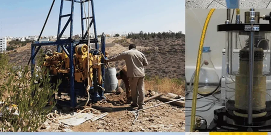
Our services
A Whitby microzonation report is only as useful as the subsurface data that constrains it. We build each model from multiple geophysical and geotechnical inputs because a single Vs30 number without stratigraphic context answers very little. The following services form the backbone of our seismic investigations in Durham Region.
Site-Specific Seismic Hazard Analysis
Probabilistic and deterministic hazard curves for Whitby sites, incorporating the 2015 National Seismic Hazard Model with site amplification factors per NBCC 2020.
1D and 2D Ground Response Analysis
Equivalent-linear and nonlinear analyses using DEEPSOIL or FLAC to model how local soil columns modify bedrock motion, critical where impedance contrasts exceed a factor of two.
Liquefaction Triggering and Settlement
Cyclic stress ratio evaluation using CPT and Vs data, following the updated Boulanger and Idriss (2014) framework, with post-liquefaction reconsolidation settlement estimates.
Frequently asked questions
When does the Town of Whitby require a site-specific seismic study instead of just using the NBCC table?
The building department typically requests a site-specific study when the proposed structure falls under post-disaster importance category, when the site is within a mapped paleo-valley or floodplain with known soft soils, or when the developer seeks a Site Class reduction to optimize the structural design. We coordinate directly with the plans examiner to confirm the scope meets the Ontario Building Code requirements.
How long does a seismic microzonation survey take on a typical Whitby residential lot?
Fieldwork usually completes in one day for a standard 50-foot lot, with the MASW line and any passive array recordings. Processing and reporting take an additional seven to ten business days because the inversion modeling requires iterative analysis to match the known stratigraphy from nearby boreholes or water well records.
What does a microzonation study cost for a project in Whitby?
Budget between CA$5,290 and CA$20,120 depending on the number of seismic lines, whether CPT soundings are included for liquefaction analysis, and the complexity of the ground response modeling. A single-family home on a standard lot with one MASW line and a basic site class letter report falls at the lower end of that range.
How deep do you investigate for a Whitby site classification?
The NBCC 2020 Site Class definition requires Vs30, which means we must characterize the shear wave velocity of the top 30 meters. If bedrock is shallower, we measure to refusal and compute Vs30 using the shorter column. Where the water table is high in the Iroquois sands south of Dundas Street, we use a seismic CPT to get a continuous Vs profile without the attenuation problems that can affect surface geophones.