Every foundation in Whitby must comply with the Ontario Building Code and the NBCC, which mandate a thorough geotechnical investigation before construction. The glacial till and shale bedrock underlying much of Durham Region create complex subsurface conditions that standard drilling alone cannot always resolve. Electrical resistivity testing, specifically Vertical Electrical Sounding, offers a non-invasive way to map these layers across larger areas. When a developer near the Whitby waterfront needs to confirm depth to bedrock beneath silty deposits, VES provides continuous profiling without the disturbance of multiple boreholes. The method works by injecting current into the ground and measuring the resistance response, which correlates directly with soil type, moisture content, and bedrock integrity. For sites where the Iroquois Plain transitions into the South Slope till, combining test pits with resistivity data gives engineers a reliable picture of what lies beneath the surface before a single shovel breaks ground.
Resistivity contrast between saturated till and underlying shale in Whitby often exceeds 3:1 — a strong signal that makes VES a reliable reconnaissance tool before committing to intrusive drilling.
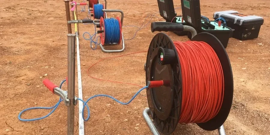
Technical details of the service in Whitby
Demonstration video
Typical technical challenges in Whitby
One recurring mistake on Whitby sites involves assuming that a single borehole log represents the entire property. In the drumlinized till plain south of Highway 401, soil conditions can change from dense silty till to soft lacustrine clay within 30 metres. We have seen excavation contractors encounter unexpected groundwater at 3 metres depth where adjacent test holes showed dry soil. Vertical Electrical Sounding catches these transitions because water-saturated zones produce a sharp drop in resistivity that stands out clearly on the processed profile. Without this reconnaissance, the contractor faces dewatering costs, schedule delays, and potential slope instability at the excavation perimeter. The Ontario Building Code requires that a geotechnical investigation identify hazardous conditions affecting construction, and resistivity surveying fulfills that requirement across the entire footprint of the project — not just at discrete borehole locations. When resistivity data flags a low-resistivity anomaly, we recommend targeted in-situ permeability testing to quantify the hydraulic conductivity before designing the dewatering system.
Our services
Electrical resistivity surveys in Whitby are configured to match the specific geological setting and project requirements. Each application below addresses a different aspect of subsurface characterization.
Depth-to-bedrock profiling for foundation design
VES lines laid out on a 10- to 20-metre grid produce a bedrock surface model that guides footing type selection and identifies zones where stone columns or over-excavation may be needed.
Groundwater and perched water detection
Low-resistivity zones mapped by multi-electrode surveys highlight saturated layers and perched water tables that affect excavation stability and dewatering design.
Karst and void detection in limestone/shale bedrock
Resistivity anomalies with high contrast to the surrounding rock can indicate solution cavities or fractured zones in the Verulam and Lindsay formations underlying parts of Whitby.
Contaminant plume mapping for brownfield redevelopment
Leachate and hydrocarbon-impacted zones alter the bulk resistivity of soil. Repeated surveys track plume migration over time, supporting site remediation and Record of Site Condition filing.
Frequently asked questions
What does a Vertical Electrical Sounding survey cost for a typical Whitby residential lot?
For a standard residential lot in Whitby, a VES survey with three to four sounding points typically ranges from CA$860 to CA$1,470, depending on access conditions and the number of electrode spreads required. Commercial and infrastructure projects are quoted based on linear metres of profile and target depth.
How deep can resistivity testing see in the Whitby subsurface?
With a maximum electrode spacing of 60 metres, VES can reliably image to approximately 15 to 25 metres depth. Greater depths, up to 80 metres, are achievable by extending the spread length, though resolution decreases with depth. For deep targets, we often combine resistivity with seismic refraction to improve the interpretation.
Does electrical resistivity work well in the clay soils common around Whitby?
Yes, it works well precisely because clay-rich soils are conductive and produce a clear signal. The contrast between clay, silt, till, and bedrock in Durham Region is typically strong enough to map layer boundaries accurately. Very dry, sandy soils are actually more challenging because they are highly resistive.
What standards apply to resistivity testing for Ontario building permit applications?
Our surveys follow ASTM D6431 for DC resistivity and are referenced to the Ontario Building Code Division B Part 4 and the NBCC. The data supports the geotechnical report required by municipal building departments in Whitby and across Durham Region.